
Hurricane Imelda Moves Into Open Waters
Imelda will gradually weaken and become post-tropical as it speeds across the North Atlantic. There are currently no direct threats to land.
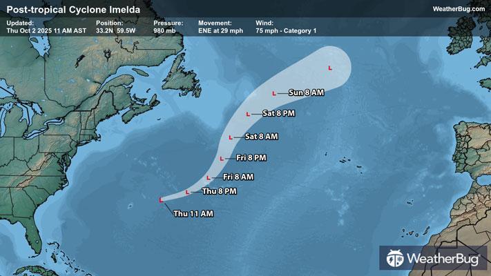
As of 11 a.m. AST, Hurricane Imelda was located near 33.2N and 59.5W, or about 315 miles east-northeast of Bermuda. Maximum sustained winds continue to decrease to 75 mph, making it a Category 1 hurricane on the Saffir-Simpson Scale. It is moving to the east-northeast at 29 mph and has a minimum central pressure of 980 mb, or 28.94 inches of mercury.
There are no longer any active watches or warnings in effect.
Imelda should become post-tropical today as it gets swept up into the mid-latitude flow and moves over cooler waters. It will take a turn to the northeast this weekend, keeping it far away from land.
Gusty winds will gradually subside across Bermuda today. There could also still be occasional rounds of moderate to heavy rain. Distant swells generated by Imelda are affecting the Bahamas, Bermuda and much of the U.S. East Coast. Swells from Imelda will also spread toward the Greater Antilles and the northern Leeward Islands on Friday and continue through the weekend. These swells are likely to cause life-threatening and rip current conditions.
With the tropical season heating up, it’s time to prepare for the season. Start organizing portable phone chargers, a radio, batteries, non-perishable food, water, and blankets into an evacuation kit now. While the weather is fair in your area, take the opportunity to scout out multiple evacuation routes from your area in case your preferred route is traffic-jammed or blocked.
Check with WeatherBug throughout the season for the latest on the tropics.