Wednesday's Weather Outlook
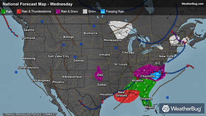
Mother Nature keeps the eastern two-thirds of the U.S. locked into a cold, wintry weather pattern, while drier and milder weather prevails for the Western U.S.
A developing low pressure system and associated cold front moving across the Southeast will be the main weather story on Wednesday. Rain showers will soak the Southeast and central Gulf Coast throughout the day. A rumble of thunder also cannot be ruled out.
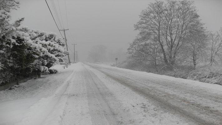
However, as colder air filters in, rain could mix with and change over to snow in the central and southern Appalachians in the afternoon and evening. Some wet snow or a mix of snow, sleet and rain could also spread into most of Virginia and western/northern portions of North Carolina late at night.
A second low pressure will drift across the Northeast, weakening the farther east it goes. This could bring some flurries or very light snow showers to interior portions. Southern New England will likely stay dry.
Meanwhile, a warm front will be lifting across the north-central U.S. for the middle of the week. Despite this being a “warm” front, temperatures will be anything but warm and wintry precipitation will be found along it. There could be some wet snowflakes or a rain/snow mix throughout the High Plains in the morning. Expect a small chance of snow in the Upper Mississippi Valley during the morning. A better chance of snow arrives in the Upper Mississippi Valley and Great Lakes in the evening.
A ridge of high pressure will expand over the western third of the U.S. Expect dry and quiet weather as a result for areas along and west of the Rockies. The south-central U.S. will also likely remain dry.
The coldest temperatures will be found over the Upper Mississippi Valley, Great Lakes, Mid-Atlantic and Northeast, with highs only reaching the teens and 20s. Thirties will occur in the Mid-Mississippi and Tennessee Valley into the Carolinas. Expect 40s and 50s for the Deep South and Southeast, but 60s and 70s persist for much of the Florida Peninsula.
The tallest stretches of the Rockies and much of the Plains will record highs in the 30s and 40s. The interior Northwest, Great Basin, the rest of the Rockies and southern Plains will see upper 40s and 50s. Milder 60s and 70s are in store for the Pacific Northwest, much of California and far southern Texas. Downright warm 80s are likely in the Desert Southwest.