Thursday's Weather Outlook
Quiet and warm weather continues for the Western U.S., while wetter weather occurs on the opposite end of the nation.
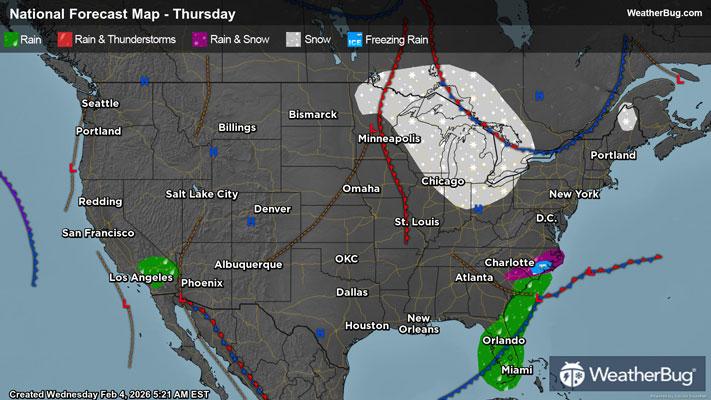
A low-pressure system will exit off the Southeast coast leaving behind some rain and mixed precipitation in the Carolinas. In the morning and early afternoon, rain showers will drift through North Carolina and South Carolina. The northern periphery of these showers may be cold enough for light snow or sleet. Any accumulations would be light and most likely confined to central and northern North Carolina. By the late afternoon, this activity will end as the rain and snow showers move offshore.
Further to the south, Florida will have showers and a few storms sweep through the state. Brief heavy downpours and a rumble of thunder or two cannot be ruled out.
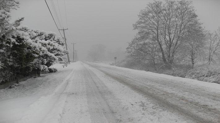
Another snowy clipper will dive southward out of Canada and into the Great Lakes and Midwest. Light snow accumulations will be possible for eastern Minnesota, Wisconsin, Michigan, eastern Iowa, Illinois, and Indiana. With colder temperatures around, roads may whiten up and cause impacts to travel. As the clipper moves further south, it will dissipate in Kentucky, Ohio, and Tennessee but may bring a few snow showers as it does so.
The Northeast and Mid-Atlantic will be cool and dry as the low-pressure system off the Southeast coast fails to come northward.
The Deep South, Mid-South, and the Plains will be dry with some warmer air beginning to enter the picture. In the Western U.S., a strong high-pressure system is keeping the weather dry and quiet with significant rain or snow nowhere to be found.
Single digits and teens will be found in the furthest north portions of the Northeast. The rest of the Northeast, Ohio Valley, Mid-Atlantic, and Midwest will see 20s and 30s. Thirties and 40s are in store for the Southeast, Tennessee Valley, and eastern portions of the Northern Plains.
A mix of 40s and 50s are anticipated for much of Florida, Deep South, Great Basin, Rocky Mountains, Four Corners, and interior Pacific Northwest. Much of the Plains will feel 50s and 60s as well as the northern to central West Coast, and southern Florida. Sixties and 70s will be common along the southern West Coast and in the Desert Southwest.